Skip to content
The Interconnected View

The Interconnected View

Different Perspectives

  • Concepts
    • What is systems thinking?
    • Applying systems thinking to problem solving
  • Te Araroa Trail
  • Pennine Way
  • Offa’s Dyke Path
  • Blog

    Map

    Tracking

    During my walk I carried a Garmin inReach device which when enabled, tracked my location via satellite. People were able to see where I was and allowed me to communicate via text messages.

    Route

    The track log diagram shows the route taken.
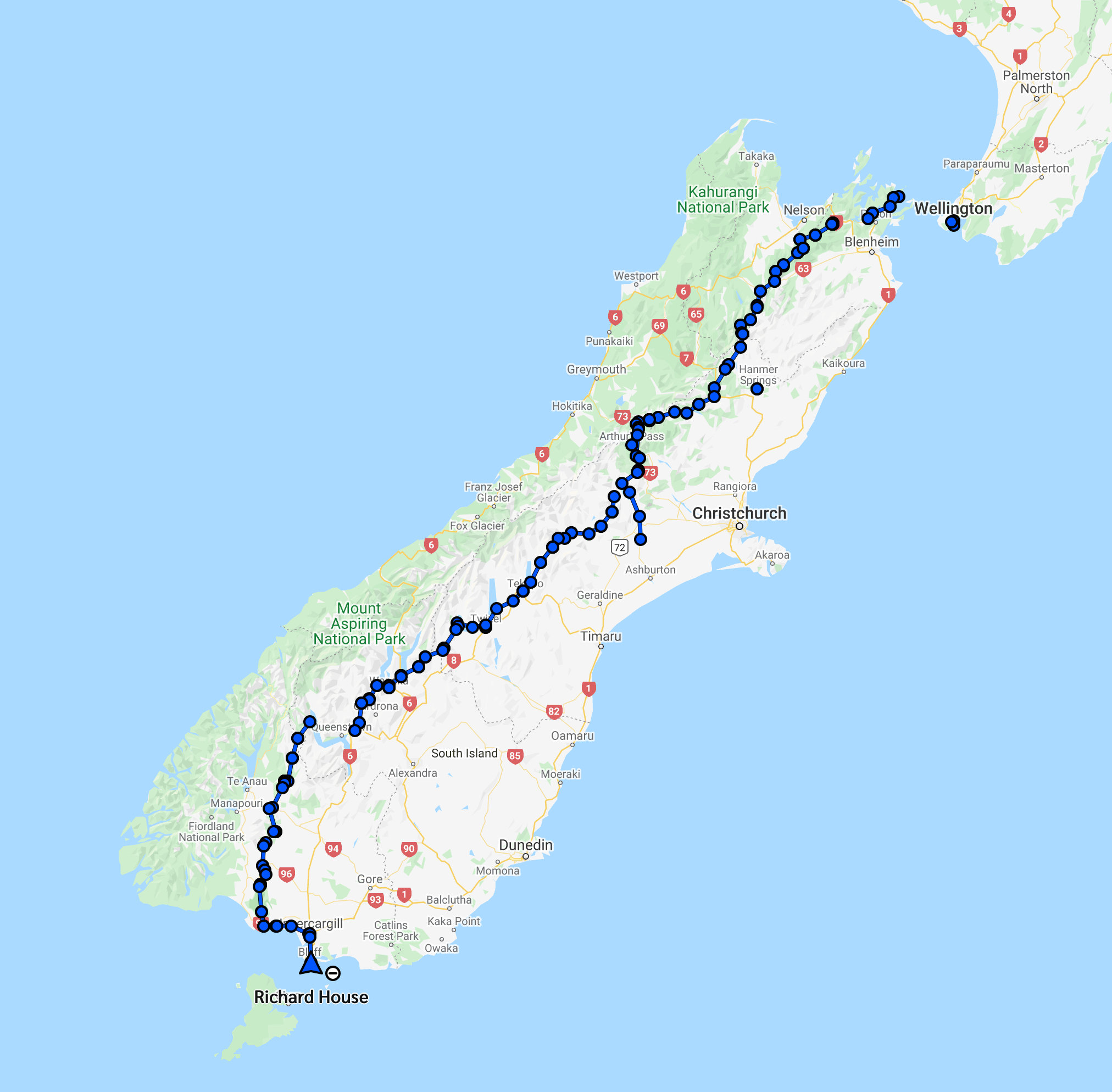
    TA Trail South Island Route

    Share this:

    • Share on X (Opens in new window) X
    • Share on Facebook (Opens in new window) Facebook
    Like Loading...
    • Concepts
    • Te Araroa Trail
    • Pennine Way
    • Offa’s Dyke Path
    • Blog

    Blog at WordPress.com.

    • Subscribe Subscribed
      The Interconnected View
      Join 78 other subscribers

      Have a WordPress.com account? Log in now.

    • The Interconnected View
      Copy shortlinkView post in Reader
      Manage subscriptionsSign upLog in
      Report this content
      Collapse this bar
    Loading Comments...
    %d